Shoreline

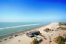
Shoreline the line of contact between the sea and the land. It is a precise boundary separating the coast, a broad zone landward from the submerged continental shelf. This line of contact is not a stable one, its position is constantly changing. In the short term, it moves as waves and tides come and go. It varies greatly as the level of the sea has changed.
The southern shoreline of Bangladesh is irregular and is formed by depression. When a large area of the earth's crust is slowly depressed and a long established continent quietly subsides, the sea spreads over the edge of the land and enters the river valley. The shoreline will then become irregular and its form will depend upon the character of the flooded land. The southern part is low-lying and consists of soft rock, the valley is broad and shallow and of the meandering type. The southeastern shoreline of Bangladesh slopes very gently to the sea and the slope is continued beneath the water to the edge of the continental shelf. The shoreline is linear and even except where it is broken by the mouths of rivers. [Md Sazzad Hossain]
See map in offshore island.
