Gurudaspur Upazila
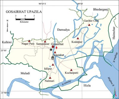
Gurudaspur Upazila (natore district) area 203.20 sq km, located in between 24°18' and 24°27' north latitudes and in between 88°04' and 89°19' east longitudes. It is bounded by singra and tarash upazilas on the north, baraigram upazila on the south, Tarash and chatmohar upazilas on the east, natore sadar upazila on the west.
Population Total 214788; male 107520, female 107268; Muslim 206571, Hindu 7688, Christian 64 and others 465. Indigenous communities such as Kaibarta, santal, oraon, Pahan, Turi and Banshphod belong to this upazila.
Water bodies Main rivers: atrai, Gur, Nandakuja.
Administration Gurudaspur Thana was formed in 1917 and it was turned into an upazila in 1984.
| Upazila | ||||||||
| Municipality | Union | Mouza | Village | Population | Density (per sq km) | Literacy rate (%) | ||
| Urban | Rural | Urban | Rural | |||||
| 1 | 6 | 98 | 110 | 32807 | 181981 | 1057 | 54.6 | 39.6 |
| Municipality | ||||||||
|
Area (sq km) |
Ward |
Mahalla |
Population |
Density |
Literacy rate (%) | |||
| 13.61 | 9 | 18 | 32807 | 2411 | 54.6 | |||
| Union | ||||
| Name of union and GO code | Area (acre) | Population | Literacy rate (%) | |
| Male | Female | |||
| Khubjipur 60 | 5559 | 9349 | 9222 | 42.7 |
| Chapila 27 | 8768 | 17329 | 17468 | 41.1 |
| Dharabarisha 40 | 8815 | 15685 | 15814 | 40.8 |
| Nazirpur 81 | 10641 | 19620 | 19619 | 38.2 |
| Biaghat 13 | 6514 | 12263 | 12188 | 38.8 |
| Moshinda 67 | 6144 | 16661 | 16763 | 37.2 |
Source Bangladesh Population Census 2011, Bangladesh Bureau of Statistics.

Archaeological heritage and relics Museum at village Khubjipur (1978), Chalan Beel Museum, Mosque at village Palshura Patpara, Mughal Mosque at village Piplar, Kusumhati Mosque (Sultanate period), Chapila Shahi Mosque, Gopinathpur Jami Mosque.
War of Liberation The Pak army conducted mass killing on 19 April 1971 in which more than one hundred persons, including Dilip Kumar Sarkar, Dr. Manindranath Sarkar and Nabaram Mazumder were killed. Freedom fighters had an encounter with Pak army at Biaghat of the upazila in which 15 Pakistani soldiers were killed.
For details: see গুরুদাসপুর উপজেলা, বাংলাদেশ মুক্তিযুদ্ধ জ্ঞানকোষ (Encyclopedia of Bangladesh War of Liberation), বাংলাদেশ এশিয়াটিক সোসাইটি, ঢাকা ২০২০, খণ্ড ৩।
Religious institutions Mosque 255, temple 28. Noted religious institutions: Chapila Shahi Mosque, Mazar of Rahim Sadhu at Sahapar.
Literacy rate and educational institutions Average literacy 41.9%; male 44.7%, female 39.2%. Educational institutions: college 8, secondary school 31, primary school 81, NGO school 95, nursery school 3, madrasa 77. Noted educational institutions: Nazimuddin High School (1956), Beelchalan Shaheed Samsuzzoha College (1969), Shikarpur Alia Madrasa.
Newspapers and periodicals Chalan Beel (weekly), Raktim (1984), Bijoy Binodan (1994), Bijoy Darpan (2001).
Cultural organisations Library 4, club 40, cinema hall 2, museum 1, theatre stage 1.
Main sources of income Agriculture 70.95%, non-agricultural labourer 4.28%, industry 1.32%, commerce 10.23%, transport and communication 2.51%, service 3.94%, construction 0.87%, religious service 0.15%, rent and remittance 0.39% and others 5.36%.
Ownership of agricultural land Landowner 54.80%, landless 45.20%; agricultural landowner: urban 35.82% and rural 57.99%.
Main crops Paddy, wheat, mustard, onion, garlic, khesari, sugarcane.
Extinct or nearly extinct crops Tobacco, sesame, jute.
Main fruits Mango, jackfruit, guava, watermelon, papaya, litchi, wood apple, shaddock, date.
Fisheries, dairies and poultries This upazila has a number of fisheries, dairies and poultries.
Communication facilities Pucca road 151 km, semi-pucca road 96 km, mud road 230 km; waterway 87 km.
Extinct or nearly extinct traditional transport Palanquin, bullock cart, horse carriage, buffalo cart.
Noted manufactories Rice mill, brick field, paper mill.
Cottage industries Goldsmith, blacksmith, potteries, weaving, cane work, wood work, chatai.
Hats, bazars and fairs Hats and bazars are 15, fairs 2, most noted of which are Chachkoir Bazar, Charak Mela and Rather Mela.
Main exports Paddy, rice, fish, date molasses, mango.
Access to electricity All the wards and unions of the upazila are under rural electrification net-work. However 49.5% of the dwellings have access to electricity.
Sources of drinking water Tube-well 94.2%, tap 1.3% and others 4.5%.
Sanitation 67.1% of dwelling households of the upazila use sanitary latrines and 28.8% of dwelling households use non-sanitary latrines; 4.1% of households do not have latrine facilities.
Health centres Upazila health complex 1, eye hospital 1, family planning clinic 4, satellite clinic 3, clinic 5.
NGO activities brac, asa, proshika, PKSF. [Md Entaj Uddin]
References Bangladesh Population Census 2001 and 2011, Bangladesh Bureau of Statistics; Cultural survey report of Gurudaspur Upazila 2007.
